May 29, 2015
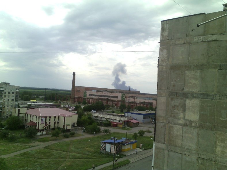
 This photo was taken from a flat in Snizhne minutes after MH17 crashed. A simple Google Image check shows this photo was first published on webtalk.ru by ‘AnnaVatavu’.
The large building with chimney must be: “Snezhnyanskkhimmash”
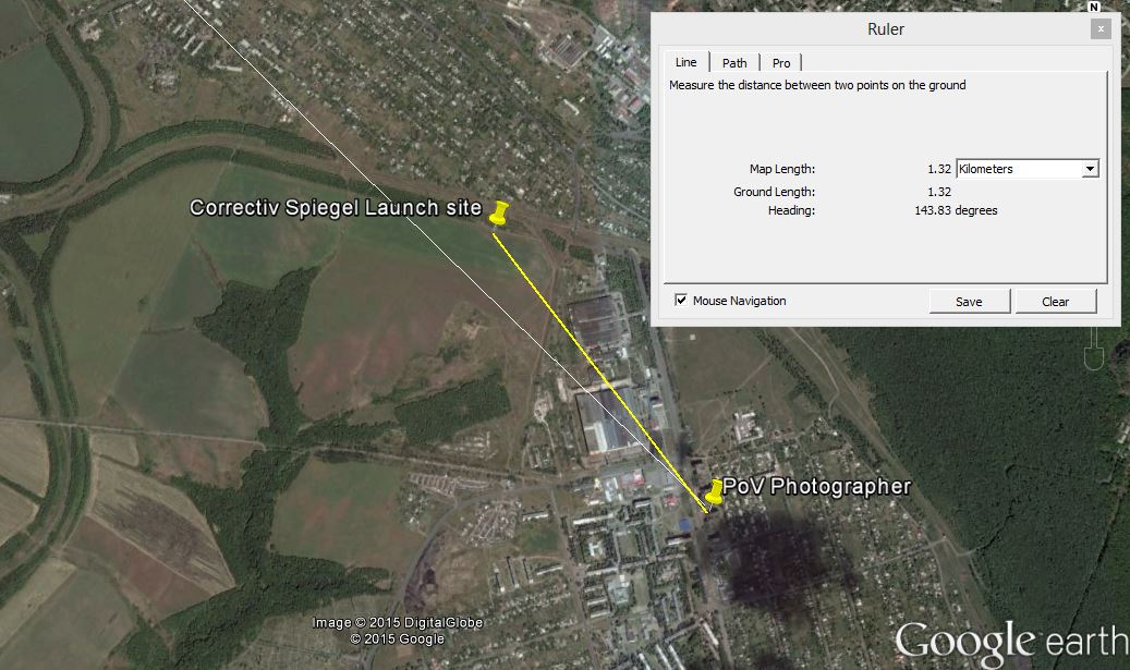
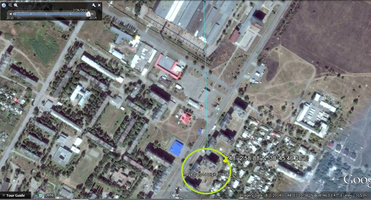 GPS coordinates: 48° 2’58.37″N 38°45’43.86″E
In the yellow circle the photographers flat with line of sight direction crash plume in Grabovo directly over the plant. Just as can be seen on the photo.
Next steps for the “Stuck with BUK” approach is to:
1) Verify if a BUK smoke plume is visible
2) Plot the area on the map covered by the photo
3) No BUK smoke plume area can be marked RED
Each time a new photo is verified a new ’empty area’ is established and marked RED on the map. After some time the map will look like a cut apple pie with red cloth showing where the pie was cut out. This process is repeated until a BUK smoke plume is found.
Let’s have a look at Google Earth now:
This is what Germans call “das Glück des Tüchtigen“
 I can hardly believe the first photo I chose for the “Stuck with BUK Research Project” seems to generate exciting new insight.
If all data correct we can establish:
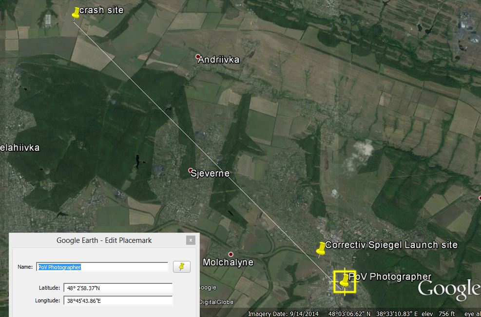
1) Distance between photographer and Correctiv / Spiegel / Algemeen Dagblad launch site is +/- 1320 meters.
2) The BUK smoke plume is exactly in the line of sight Photographer / Crash plume
What conclusions can we derive from all mentioned above?
It is tempting to issue following claim:
“The Correctiv / Spiegel / Algemeen Dagblad launch site never existed because we clearly demonstrated there is no Buk plume visible”.
The devil is in the details and I think it is too early to put forward any claim.
Let’s try to add the path the BUK would have followed if it was launched from the claimed location.
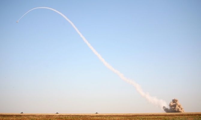
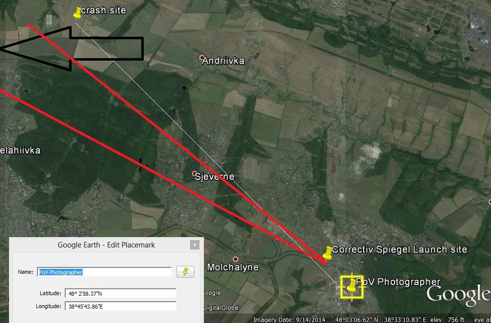
a) I am not a rocket scientist. I don’t know which trajectory a BUK would follow after launch under which specific circumstances.
b) My rough best guess is the missile would have flown in the direction Point of Impact, that is to say, in the direction indicated by the black arrow and somewhere between the red lines.
I used following:
GPS coordinates: 48° 2’58.37″N 38°45’43.86″E for PoV photographer
GPS coordinates: 48° 3’32.74″N 38°45’5.96″E for ‘Launch Site’
GPS coordinates: 48° 7’50.70″N 38°38’28.41″E for Grabovo Crash plume
My proposal: let’s discuss the data and see what conclusion(s) we can draw.
To be updated regularly
*Useful links:
Correctiv Report:
https://mh17.correctiv.org/english/
Photo in report about launch location
https://mh17img.correctiv.org/wp-content/uploads/2014/12/Detail-Snizhne-3.jpg
Gives me Google Maps:
https://www.google.com/maps/@48.0550873,38.7469357,2326m/data=!3m1!1e3
Double check with @markvandenber data:
http://www.whathappenedtoflightmh17.com/an-overview-of-possible-buk-launch-locations/
Update May 29 Analysis Michael Kobs (53 pages, 7.6Mb )